搜索结果: 1-15 共查到“工学 impacts”相关记录112条 . 查询时间(0.093 秒)
Academy of Mathematics and Systems Science, CAS Colloquia & Seminars:Impacts of trade conflicts on the energy sector
贸易冲突 能源部门 影响 能源
2023/4/19


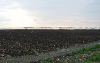
Farms,tables and revealing the vast impacts between and beyond(图)
Farms tables revealing vast impacts between beyond
2020/12/11
Bountiful harvests in one location can mean empty water reservoirs and environmental woes far from farmlands. A study published in Nature Communications examines how food, energy, water and ...

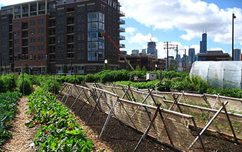
Food systems are fodder for curbing cities' environmental impacts(图)
Food systems fodder curbing cities environmental impacts
2020/3/20
Focusing on urbanization as a key driver of environmental change in the 21st century, National Science Foundation-funded scientists at Princeton University have created a framework to understand and c...

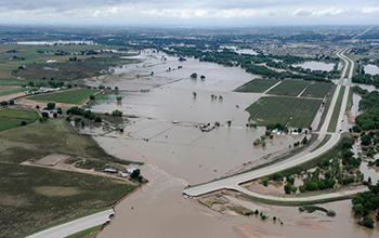
Community impacts from extreme weather can shape climate beliefs(图)
Community impacts extreme weather shape climate beliefs
2019/10/28
Recent studies suggest that people who experience hurricanes, catastrophic flooding or other severe weather events are more likely to believe in, and be concerned about, climate change in the wake of ...
Impacts of Central Tire Inflation Systems application on forest transportation – Review
timber transportation road maintenance transportation cost vehicle mobility fuel consumption safety
2017/6/26
Central Tire Inflation Systems (CTIS) have been introduced to forestry transportation in the last 30 years to the point the forest industry is one of the biggest users of the technology (Pletts 2006)....
ASSESSING THE IMPACTS OF FLOODING CAUSED BY EXTREME RAINFALL EVENTS THROUGH A COMBINED GEOSPATIAL AND NUMERICAL MODELING APPROACH
Extreme rainfall Flooding Impact assessment 2D Flood modeling LiDAR Landsat
2016/12/1
In this paper, we present a combined geospatial and two dimensional (2D) flood modeling approach to assess the impacts of flooding due to extreme rainfall events. We developed and implemented this app...
ASSESSING FLOOD IMPACTS IN RURAL COASTAL COMMUNITIES USING LIDAR
coastal flooding lidar transportation
2016/12/1
Coastal communities are vulnerable to floods from storm events which are further exacerbated by storm surges. Additionally, coastal towns provide specific challenges during flood events as many coasta...
IMPACTS OF TREE HEIGHT-DBH ALLOMETRY ON LIDAR-BASED TREE ABOVEGROUND BIOMASS MODELING
tree aboveground biomass lidar allometric equations simulation regression
2016/11/30
Lidar has been widely used in tree aboveground biomass (AGB) estimation at plot or stand levels. Lidar-based AGB models are usually constructed with the ground AGB reference as the response variable a...
DETERMINING THE IMPACTS OF LAND COVER/USE CATEGORIES ON LAND SURFACE TEMPERATURE USING LANDSAT8-OLI
Land Surface Temperature Tasseled Cap Transformation Istanbul Landsat 8 OLI
2016/11/30
Due to unplanned and uncontrolled expansion of urban areas, rural land cover types have been replaced with artificial materials. As a result of these replacements, a wide range of negative environment...
ASSESSMENT OF FLOODED AREAS PROJECTIONS AND FLOODS POTENTIAL IMPACTS APPLYING REMOTE SENSING IMAGERY AND DEMOGRAPHIC DATA
Floods Climate Change Impacts Climate Change Vulnerability
2016/11/30
Assessing vulnerability and potential impacts associated with extreme discharges requires an accurate topographic description in order to estimate the extension of flooded areas. However, in most popu...
EYE TRACKING TO EXPLORE THE IMPACTS OF PHOTOREALISTIC 3D REPRESENTATIONS IN PEDSTRIAN NAVIGATION PERFORMANCE
3D photorealism eye tracking cognitive workload,
2016/7/8
Despite the now-ubiquitous two-dimensional (2D) maps, photorealistic three-dimensional (3D) representations of cities (e.g., Google Earth) have gained much attention by scientists and public users as ...
New science helps put spotlight on unseen global impacts
New science spotlight global impacts
2016/2/23
As the world grows more connected, “out of sight, out of mind” looms as a perilous consequence of globalization. A sustainability scholar presents an integrated way to track the many footprints that a...
Impacts of a Resolution-Pyramid on Gibbs Random Field Classification
Segmentation Texture Classifi cation Multiresolution Hierarchical Spatial IKONOS
2016/1/25
In this paper we describe how to extend the Markov/Gibbs random field model used for texture classification to a multi-resolution
approach in the context of land cover analysis. Our metho...
REMOTE SENSING FOR ASSESSING ENVIRONMENTAL IMPACTS BASED ON SUSTAINABILITY INDICATORS
Satellite remote sensing Spatial databases Interferometric SAR Crop management Sustainability Indicators
2016/1/3
Sustainable development is that which meets the needs of the present without foreclosing the needs or options of the future. Many studies have been published on how to assess sustainability using indi...


